- Screen Colours:
- Normal
- Black & Yellow
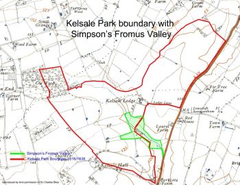
Simpson’s Fromus Valley is not just a series of species-rich flower meadows: it has a fascinating history which has been researched for some years by Dr Rosemary Hoppitt, with further recent work by volunteer John Rainer since the site was taken over by SFPT. The Reserve, close to today’s busy A12 while retaining a strong sense of rural isolation, sits close to the centre of the site of Kelsale mediaeval park: a 500-acre landscaped historical feature that probably dates to the 12th century. The park was one of many across Suffolk held by the Earls and Dukes of Norfolk (including the Bigods, the principal builders of Framlingham Castle) and which were created and used during the 12th to 16th centuries.
Typically, parks would have had, in addition to deer, a number of other land uses. There may have been dovecotes, fishponds, grazing livestock, woodland managed for timber and firewood production, salting facilities for preservation of venison and fish. There are several medieval sources that mention Kelsale Park, deer and its fishpond.
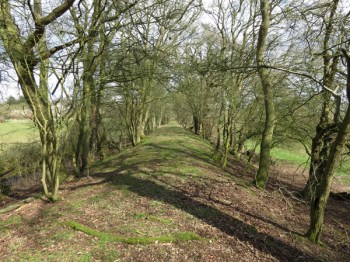
Today, when you visit the Reserve, you can see the remaining features of all this activity: a flat raised meadow where finds of potsherds may indicate habitation and – most impressively – a 200-metre earthwork which formed a dam across the valley.
This dam would have held back the water for the huge fishpond, which is now dry. Mere Meadow lying upstream from the dam recalls the former fishpond, which would have extended upstream some 600 metres.
We have a detailed history of the medieval Kelsale Park, written by our Archaeologist John Rainer in 2015, and updated by him in 2020. It transports you back to the days when the park was the centrepiece for a family of leading medieval noblemen. "Simpson's Fromus Valley and Kelsale Park: A Brief History of the Medieval Park" can be downloaded from «Our Publications» page here.
If you are interested in the dam earthworks and its associated features, many of which can still be seen in the Reserve today, then John's complete guide (updated in 2020), "Simpson's Fromus Valley and Kelsale Park: A Guide to the Earthwork features of the Reserve" can be downloaded from «Our Publications» page here.
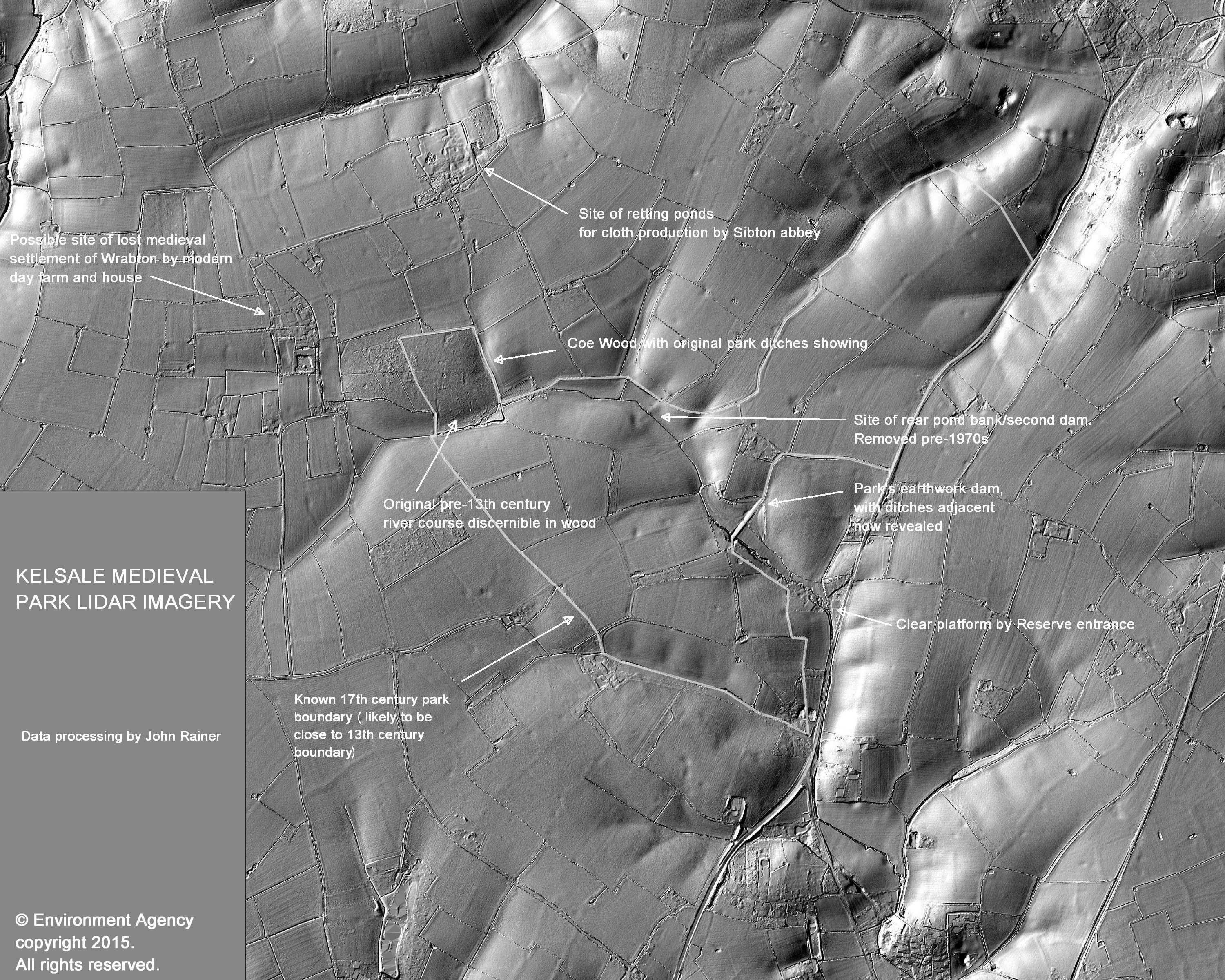
The Environment Agency’s Geomatics Group has LIDAR data available free of charge via licensing for private and non-commercial use. Aerial LIDAR uses a laser to measure the distance between the survey aircraft and the ground surface, including buildings and other features such as above-ground pipelines, highways, street furniture, power-lines, railway tracks etc. One of its key features is the ability to strip away all but the densest vegetation to show the ground surface beneath.
The Suffolk Flora Preservation Trust has been able to use this data to produce stunning 3D imagery of Kelsale Park and the surrounding landscape. This has resulted in features such as the park dam and Coe Wood being shown in unprecedented detail. Furthermore, the height values used to produce the image are so accurate that the faintest of ground level changes can be seen. Former field boundaries, trackways and other earthworks abound across the landscape.
 |
 |
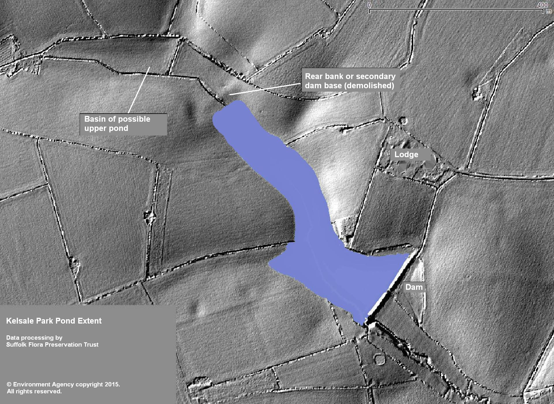 |
| original LIDAR image | annotated with key features | likely original pond extent |
Click on each of the images above to enlarge them ...

You also might like to read about Fromus Valley's recent natural history.
☞ To provide protection to sensitive flora, the gates to both reserves are normally locked, and the reserves are closed to unauthorised visitors. Each site is open two or three mornings a year when members of the public are welcome. Visit our Open Days page for more information.